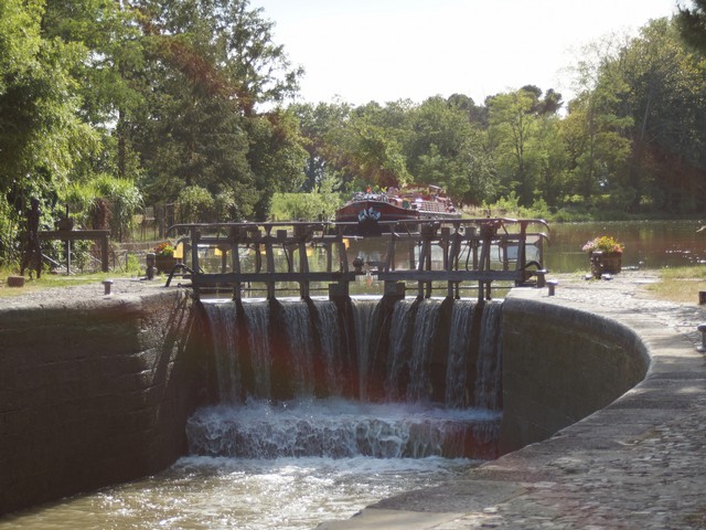
The Canal du Midi and La Redorte
Enjoy a walk along the towpath, see the canal boats go by and look out for darting kingfishers. Access to the towpath is just 2.5km from the village, or if you prefer you could drive to Homps or La Redorte and start your walk there. There are also three circular walks from La Redorte which are a good way to explore the countryside.
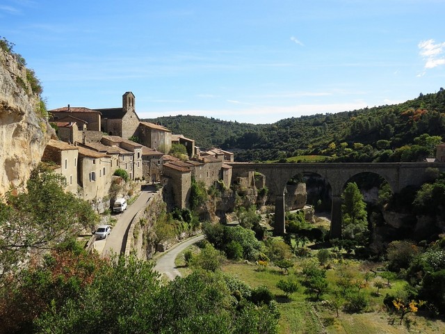
From Minerve
This fortress village is in a stunning location and is rich in history. It lies just on the edge of the Parc Natural Régional du Haut-Languedoc, on a rocky outcrop between the gorges cut by the Brian and Cesse rivers. There are amazing walks from the village, though some may challenge your nerve and agility!
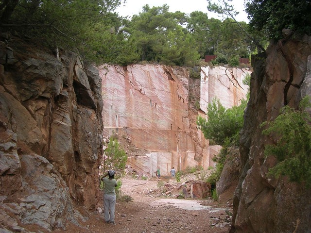
From Caunes Minervois
Some excellent marked walking trails lead from this medieval village nestled at the foot of the Montagne Noire; or you can walk around the edge of the marble quarry, worked since Roman times, which provided marble for the Grand Trianon at Versailles and the Paris Opera House.
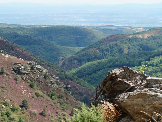
The Haut Languedoc
From Pradelles-Cabardes (24 miles/38km drive) you can reach the Pic de Nore, the highest point in the Montagne Noire at 1,211 metres. The view from the top is staggering – you can see the Pyrenees, the Corbières, the Mediterranean sea, the Toulouse plain and the Lacaune Mountains.
Saint-Pons-de-Thomières is a good place from which to start to explore the higher reaches of the Parc Naturel Régional du Haut-Languedoc. The information centre can provide walking routes, advice on bird watching and much more.
Olargues is a Plus Belles Villages de France and is almost encircled by its river. There is great hiking to be had in the surrounding hills – though some may find a walk through the picturesque winding lanes and up the steep hill to the church quite challenging enough.
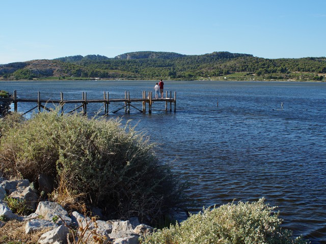
Les étangs et les Massifs
A ramble around the étangs to discover the scenery and birdlife of the Parc Naturel Régional de la Narbonnaise en Méditerranée shouldn’t be too demanding. From Bages, there’s a marked circular walk from the étang up through the pine forest to a panoramic viewpoint, descending past vineyards, almond trees and cypresses. Or from Peyriac-de-Mer there are two very easy marked walks exploring the lagoons and salt flats.
The Massif de la Clape is more challenging. Its name comes from the Occitan word clapas, meaning ‘pile of stones’ – perhaps because it consists of high, rocky plateaus punctuated by deep, narrow ravines. It has many vineyards and its own prestigious AOC designation. If you take the steep path up through the sailor’s cemetery you will reach the chapel of Nôtre Dame des Auzils, with stunning views over the coast.
The Fontfroide Massif has many footpaths; some have existed since ancient times, others since the middle ages when monks lived in the famous abbey below.
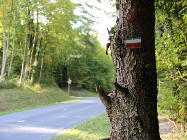
Finding your way
Long distance hiking trails are known as Sentiers de grande randonnée (GR). They are well marked with a red band above a white band painted on trees, posts or stones. Paths for local hiking are called Chemins de petite randonnée (PR) and marked using yellow bands. There is a national network of GR and PR routes, with 38 marked paths in Aude and 40 in neighbouring Hérault. Even so, do invest in a good map – the IGN series are the most useful for walkers.
The following links may also be helpful: